"Surely it's got to be Paul Simon?"
"Got to be."
This was not how I'd expected my day to end, coming last in a pub quiz in Long Preston, having a few drinks and enjoying the free chips. But then it had been a day in which I'd already learnt a lot: that Grenadine is made from pomegranates; that Carl Douglas, singer of 'Kung Fu Fighting' looks like Fatman Scoop; and that Dave and were capable of walking 23 miles and ascending the three tallest hills in Yorkshire in a day.
I hadn't expected Dave to agree when I had floated the idea of doing the Yorkshire Three Peaks, months before when the nights were still long and the thought of taking on such a challenge seemed reassuringly distant. I certainly didn't expect him to agree to try it on his birthday. But the fates conspired with us, and so shortly before 9am on Friday June 24th, we shouldered our rucksacks and walked out of Horton-in-Ribblesdale.

The first thing you'll notice, if you or anyone you know has done this challenge or anything similar, is that 9am is not a particularly early start. Neither Dave nor I are constitutionally capable of being morning people, so eating breakfast at 7.30am and walking before 9am actually represents a success for us. It also means that you're unlikely to see many others taking on the same route, as they all left at least a couple of hours previous to us. When we overtook a group of blokes at the end of the day, it felt like being a Formula 1 racing driver lapping a backmarker, rather than the truth that we'd managed to catch up another group of people whose grip on what constitutes 'a good time' was as loose as ours.
I can also confess to you now that, although I'd actually gone and bought the right OS map for the walk, we started out planning to navigate simply with four pages extracted from an old walking magazine. They are somewhat easier to handle in a stiff breeze than the full OS map, but did have the downside of being a bit sketchy on details, distances and directions. We maintained the usual confidence we show in these situations (see navigating around Canada by table napkins and postcards), although the actual map did come out as final arbiter on a few occasions.

Starting from the village, we took a track up from Brackenbottom to meet the Pennine Way, before climbing the steep and rocky slope to the summit of Pen-y-Ghent. Taking a little over an hour and ten minutes, this three peaks malarkey seemed like a breeze. Time for a summit photo, a quick cup of tea, and a check of the map to get the right descent route. Little did we realise that the next ten hours wouldn't seem quite so straightforward.

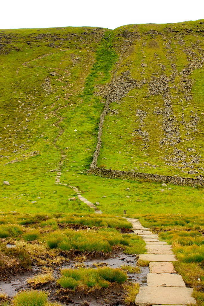
The rain started splattering as we cut onto the track which leads across moor and bog towards Whernside. Waterproofs came out, and hats and gloves were donned to stave off the biting wind. As it got damp underfoot, we commented to one another, 'ah, well, it does say it gets boggy'.
Boggy would be an understatement for the next few miles of walking. The undulating moorland provided a clear view of Ingleborough and Whernside in the distance, but the topography also meant that the recent rain collected in each hollow, leaving soggy moss, reeds and peat bog to cross. Footsteps showed that our predecessors had gone wider and wider in each attempt to get across. We rapidly learned to distinguish between plain old mud (wet, slippery, but likely to have a solid base underneath) and bog (superficially similar but seemingly without end). My sharpest lesson was when, feet sinking rapidly, I took a bold plunge to try and get across a wide channel, only to find one leg had disappeared to thigh level without hitting anything solid. You know the noise you hear on wildlife programmes when baby animals find themselves in this predicament? It turns out that noise is involuntary, as I honked and squeaked at the fact that I was flailing, trying not to sink, struggling to escape with my boots and body intact. I made it out but I don't fancy doing that again, if you don't mind.

We decided to call this the bog of eternal doom.
We squelched on across the moor, picking the driest path we could find, but it made for painstaking progress. The alternative was thrown into sharp relief when we were passed by two fell runners, covered from head to food in bog mud, and likely to be finished on their circuit long before us. I was wet and soggy, but not that wet and soggy.
Firm ground under our feet, the sun broke through the cloud to greet our arrival on the road to Ribblehead. When I'd seen the viaduct on the horizon, I had been disbelieving of the notion that I would be able to walk all that way. Now, despite the heaviness I was feeling in my legs, Dave and I were sitting right beneath its arches, eagerly devouring our lunch. I think deciding where to stop to eat was the closest that we came to an argument all day – more than a little amazing, considering our ability to stubbornly hold diametrically opposed views on the most minor of things. But it wasn't surprising that we were a little grouchy by that point – with a fair few miles gone, and six hours since my porridge breakfast, I was famished.

To be deemed to have completed the Three Peaks challenge, your walk needs to be done in under 12 hours. Not satisfied with that as a target, Dave had concluded that 10 hours was a nice round number to attempt. As we sat at the foot of Whernside, I began to seriously doubt how possible that was. The route picked out by our anonymous magazine writer took a direct (and steep) route up the front of the second peak, shaving distance but also making for tired legs. With a final effort, I joined Dave at the top of the 45 degree slope, and we walked the last few hundred metres to the summit shelter and trig point.

The view from the top of Whernside was outstanding – by far the most satisfying of the three, the shape of the summit providing a great panorama, and, through a combination of good weather and visibility, being able to see Ingleborough and Pen-y-Ghent clearly. Pen-y-Ghent now seemed a satisfyingly long way away (although I was concerned to remember that our car was over there) and having made it to the top of two hills, a psychological barrier seemed to come down and I began to believe I was going to be able to do this without my legs dropping off.

We were still trying to stick to our schedule so after the briefest of stops on the summit (quick photo, and a chance to apply gaffa tape to my heels to stop blisters), we were off down into the valley, and looking up at the final slopes of Ingleborough. We had a quick stop to chat to a walker who pointed us in the right direction for the path across the Nature Reserve, and who assured us that the descent into Horton was around three miles. Later in the day, I would reflect on how inaccurate his estimate was, and wish all sorts of vengeance on him. I apologise if he suffers any stabbing pains in his knees on future walks.

Ingleborough, like Whernside and Pen-y-Ghent, is surrounded by peaty bog but unlike Pen-y-Ghent, Ingleborough (and Whernside) both have delightful paths with large stones or boardwalks to give the tired and ailing walker a nice solid surface to walk along. This also makes for super-easy navigation, despite being somewhat dubious when I saw that the path we were on took a very direct, nay vertical-ish, line towards the summit plateau. It is possible that I may have been over-exaggerating through exhaustion.
Or perhaps not.
In any case, with the aid of my newly-invented coping mechanism (it's easy: take 100 steps; stop and rest. Repeat til the top), we were soon striding across the plateau towards the last trig point, where we celebrated with a drink of water. As we huddled in the summit shelter, preparing for the last part of the journey, I dug deep into my rucksack and pulled out the fruitcake I'd made and iced for Dave's birthday, lighting a candle which threatened to go out instantly, while I sang 'Happy birthday'. He seemed pleased, surprised, but most of all, hungry!

Camera is actually balanced on the trig point!

With Pen-y-Ghent as our directional marker, we started down the descent, all the adrenaline of completing the peaks draining away, to be rapidly replaced by tiredness and the overwhelming wish for the day to be over. The walker who'd estimated 3 miles from the peak back to the village proved to be inaccurate by an order of almost 100%, and so the confidence that we'd make our arbitrary 10 hour target was stymied by the extra hour it took to walk those final few miles. The rain had just started as we got back to the car, pretty much exactly 11 hours after we'd left. My smile was broad as I donned my flipflops and we headed back to our B&B, for a shower, a meal, and that pub quiz.
You can see the whole set of photos Dave took on the day here.
